Showing posts with label hike. Show all posts

Saturday, 3 October 2015

While I was in the bathroom

While I was in the bathroom, Kat and Laurel hatched a plan for us to spend the day in Liechtenstein! Kat had originally thought it would be nice to walk across a country and, understandably had considered Liechtenstein a top contender. She was chatting to Laurel about it and Laurel kindly offered us her car for the next day instead!

What a present!  A car to have to independence to travel around Switzerland and Liechtenstein for the day!  We set out (not too early) for Vaduz, a simple 2 hour drive from Laurel's at Kilchberg only stopping to pick up our train tickets to Innsbruck for the next day. Our hastily manufactured plan was mainly focused on doing a walk along the "Prince's Way", above the Liechtenstein Castle.  First we stopped off for a map and a drink, wandering the street in Vaduz and poking around to learn a very little bit about the place.  I learned more than I did from watching The Knight's Tale but I do not think I am likely to win any history awards for this region of the world.


Not enough castles have views these days

Kat loved this statue in town
I wanted to understand how Liechtenstein could become such a wealthy independent nation (with unemployment as low as 1.5% in 2007) with a parliament and a popular monarchy that still holds a lot of power.  The key to the wealth is obviously low corporate taxes, with more corporations registered there than there are citizens.  But I am not sure how they really became or developed their independence from the nations around.  Of course, it turns out that it is "kind of complicated".  From what I understand, when Napolean "took over" the Holy Roman Empire, he banished many of the pre-existing structures.  And then, when Napoleon was deposed, the vaccuum left behind allowed Liechtenstein's monarchy to do some clever politicking, to set itself up first as part of Austria-Hungary and then independently but linked with Switzerland.  Really, it would just be better if you read the wiki, and if you really want to understand it, probably go and find an better source of information!

It was a beautiful sunny day, and we were counting our blessings as we wove Laurel's car up the mountain road to Geifels, the start of the Fürstensteig (The Princes' Way) walk. It was great how quickly we left Vaduz behind on the small winding road, only once having to back downhill to let a fat bus through.  The walk was cold in the shade and toasty in the sun, once we cleared above the treeline, we could see over the Rhine Valley where Vaduz sits.  It was fresh and beautiful up there and another throwback to Nepal where sometimes we had to grab onto a cable while walking/scaling across a rocky area.

We didn't make it all the way to the Three Sisters but did enjoy sitting up in the clean mountain air, admiring the tiny country in front of us.  Fun fact: a survey in 2006 using updated technology found that Liechenstein's borders are actually 1.9km longer than previously thought!

Probably the best outcome from any bathroom trip I've made.


Views on the way up
Channeling my inner donkey whisperer
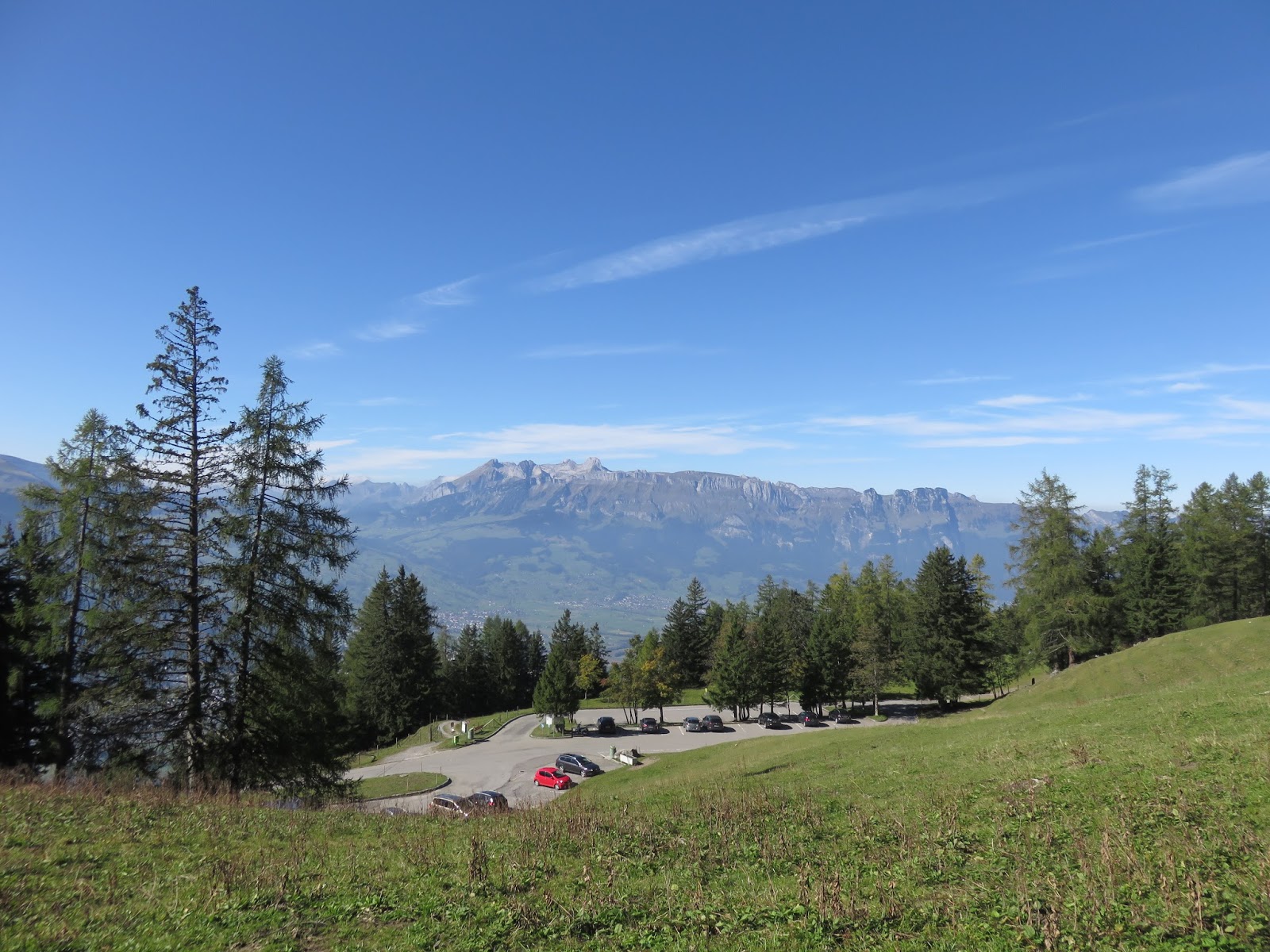
Best view from a car park since the Bernina express (which was less than 3 days before!) 


We were not crushed by falling rocks


Not bad 'eh?
Looking out


Top of the world!
Spot the Kat
Looking down


Bliss


What a walk!
Still with an eye out for rocks above
A final look back at Vaduz as we left
We could even take them with us in the car

Monday, 31 August 2015

Spain part 1: Santander and Somo

Santander was a beautiful place to spend a month. 


We knew we wanted the flexibility in our trip through Europe to stay in the one spot for awhile and as our journey progressed we decided Spain was the place. Originally (so long ago now!) for our time in Spain we thought we could get jobs or volunteer as well as some hiking along the Camino de Santiago (St James' Way) but that evolved.  We decided we were most excited about staying put for a month somewhere near the beach, and do small walks on the El Camino de Santiago.  Doing a huge part of the walk was out of the question (I think that it is more than 800km long), but setting ourselves up in the beach-side town of Santander meant that we could do a few parts of the Camino Del Santiago Del Norte quite easily. 

In the end even that turned out differently than we imagined. Kat finished off some research work then got sick (and now has stories to tell about a home visit from a Russian speaking doctor and a trip to the emergency room). Whereas I landed a job working remotely for a client in Australia that allowed us to save up some additional travel money, but this did tie me to a computer. We learned some Spanish (but there's a lot more to go!), and we saw some amazing sights. Little did we know that Santander was once summer residence of the Spanish royalty, but more on that later.

Beaches
The first week in Santander was really hot and we took the opportunity to visit three of the best beaches in Spain, according to Rough Guides.  We went to Playa de la Magdalena, Somo & El Sardinero; all of which lie along the Camino Del Santiago Del Norte  and all are very close to each other and all beautiful in different ways. The beaches were full of Spaniards enjoying the final weeks of the summer holidays. We enjoyed watching some play paddle ball and alternated reading in the sun with swimming in the ocean. It was so lovely to be at the beach as it had been awhile!

La Playa de la Magdalena
El Sardinero

El Camino del Norte
"The Way of Saint James" follows the legend that St James' remains were taken from Jerusalem to the city that is now known as Santiago de Compostela.  Although a pilgrim could take any route to get there, regular routes developed over the centuries.  Nowadays, the northern (del norte) walk has about 20 pilgrims starting per day and follows the northern coastline whereas the standard or "the French" camino (so-called because traditionally most pilgrims were French) can draw up to 200 pilgrims per day, particularly in the peak season (source).  The weather is probably less reliable in the north, and apparently goes up and down a lot more.  Overall, I think there are a number of reasons to pick the French route over the north, but we were happy to join a part of the north route along the beautiful coast.  Luckily for us, it passes through Santander. 

On our first weekend, we took the local ferry across the bay where locals go for warmer waters trapped in the bay by the sand bank (no Dolphin Sands Road-ing here, although one would think that the real pilgrims would go all the way around).  With our tent, backpack and hiking shoes, we didn't really fit amongst the beachgoers who I am sure never wear sunscreen.  

A little out of place at Somo
We had a pleasant walk along to sand dunes and beach for a few kilometres to reach the campsite at Somo.  After a bit of a standoff with a waitress where I was trying to explain that I only wanted one meal and she was only trying to find out our table number, we left for our (reverse) walk along El Camino del Norte.

A beautiful coastline
Deep in thought
This walk took us along the clifftops by Somo where we saw the true wrath of the Atlantic, again like our visits to the Cliffs of Moher and other places in Ireland. With nothing to stop us falling off, and no idiots trying to get that perfect photo likely to fall off, we quickly left the busy-ness of the beach and Somo behind and thoroughly enjoyed the combination of sun and wind.  


Kat making friends with el Camino del Norte
Kind of wish they moved after 2 hours (we passed them in both directions)
It seemed a strange place to find a crop of maize, but that's indeed what we found, alongside wild berries, that I foolishly tried to eat.  The picturesque walk along a dirt track, sometimes overgrown with berries was quiet and peaceful and ended in a steep descent into a cave-like bay where we took a dip and briefly read our books. 

The downwards climb at the far end of our loop
Our return to Somo coincided with my ability to finally internalise (and express) the word for 'ice-cream' and we settled in for a night interrupted "only" by what I would describe as a cannon, or some other ear-splitting explosive device, going off every hour, something that took me back to the traumatic experience of sleeping in the backyard of a train station in Edinburgh.

Sunday was a lovely day, a long sleep-in to then wake with coffee and pastries on the beach, which we visited tent and large backpack in hand and enjoyed for the remainder of the day before a comfortable ferry ride back to our cosy room in Santander.  Although we did not earn a plenary indulgence, or a compostela/certificate of accomplishment (only awarded for those on a religious journey who make it to Santiago de Compostela and who walked over 100km), we did have a great weekend, with many of the things we both enjoy.  Food, coffee, walking, camping, and beaches.

El Camino

Monday, 13 April 2015

SaPa and surrounds (Travel Dream!)

Seven years ago I first heard about SaPa from a fellow traveller in Hanoi. I researched the place and was sad to conclude I could not do it justice with the remaining time I had left in Vietnam. Since then I had hoped to come back to visit the rice terraces and people of SaPa. In fact, it was one of my main travel dreams for our big 2015 trip. We decided to spend 5 days hiking and relaxing in the area.

A view from the top
The views in and around SaPa were spectacular and it was fantastic to be outside hiking in fresh air again, even in the extremes of weather we experienced. Our first day hiking along and up rice terraces was extremely hot. Then at one point on the second day you could not see more than 5 metres in front of you due to the fog. After that, the weather was decidedly chilly but our time was still enjoyable.


Rice terraces filled with water
We decided to hike what is a fairly typical route to the south-east of SaPa. Hoping to avoid some of the crowds we often opted for the “hard way” over the “easy way.” It really wasn’t so busy, however, and I think even in peak season the crowds would not spoil the view.


Living the dream!
Rob balancing along


Slippery slope
Though the scenery is what draws many people to SaPa, for us, the best part was finding out about our guide, Chai, SaPa Sisters and the H’mong people. Only slightly before we arrived in SaPa I had found out about a trekking company called SaPa Sisters. They were linked with the hostel we stayed at and turned out to be an excellent organisation. It became very clear to us that becoming a trekking guide with SaPa Sisters is a great means for a woman to find independence. Though many H’mong women act as guides for treks around SaPa they often see little of the tourist dollar, with it instead going to tour companies in Hanoi. SaPa Sisters is run out of SaPa and the guides are paid directly by the customers and are entitled to maternity and sick leave and generally see more of the profits than they would at another organisation. Chai had worked with the company for five years, learning English from tourists and was very independent.

Our wonderful guide Chai
In SaPa we visited a museum which told us a bit about H’mong culture. If a man wants to marry a woman he will “kidnap” her. During this process she stays with him and his family and both parties decide if the marriage will go ahead. Chai told us about her views on the process. In addition to the fact that she was trekking on a day when women traditionally get “kidnapped”, she said she didn’t like the method and if a man had tried, she would not have considered marrying him. She said her husband was a good man and together they had a young toddler. I found it incredible she was 7 months pregnant with her second child during our trek! She said with her first child she had wanted to stop at 8 months but her Mum told her it was good for the pregnancy to walk. Perhaps the proof was in the pudding, so to speak, as her labour period was very short.

On the first night of our trek our homestay host was Ms Thanh in Lao Chai. Also there was a Newfoundland guest, Aimee, and her guide, May. It was great to talk to them and hear May’s perspectives on life. May actually worked for another company were the pay was not as good but she filled in with Sapa Sisters when they needed her. H’mong women are expected to marry and start a family young. May was about 19 years old. She and Chai told us that at 21 a woman is considered to be getting to old to marry. Chai originally did not want to marry and was 21 herself when she eventually did.

Ms Thanh, May, Chai and Kat
During our hike Chai pointed our some plants that were unique to the area. I was very excited when she showed us a plant whose leaves closed up when you touched it. It was an interesting defence mechanism and we couldn’t stop trialling it! In fact, I think it is so great that I have started to use the leaves folding in as a way to indicate when I feel sad or defeated. We also tried some berries and grass that Chai gave us. She warned us against a particular plant’s poisonous leaves because if you eat it you would need your stomach pumped or it will kill you.


You can eat these berries
On our second night we stayed at a larger family-run homestay in Ban Ho. A group of Americans and a couple of French were also guests that night. The duck I said hello to on the way into the house turned out to be dinner. I chose not to watch it being killed. As with the first night, we tried some of the local rice wine. This time it came paired with a confusing card game that no one really had a good handle on. (It was no UNO special rules!)

The family we stayed with in Ban Ho were Tay people and the village was made up with H’Mong and Dao people as well. There are seven minority groups in the surrounding areas of SaPa. I find it incredible that they so many groups living so close to each other that have each kept there culture so strong. It is hard to know exactly which ways the Vietnamese government and the Vietnamese influences their lives but Chai gave us a few indications. For one thing, generally the H’mong do not consider themselves Vietnamese.


A Red Dao woman at work
Little person at our Ban Ho homestay


Chai told us many more things about the lifestyles and traditions of the people in and around SaPa. When a woman marries they must move to live with their husband and his family, leaving their own community behind. This means many changes for the woman, especially if they are marrying into a different minority group and have to give up their culture.

This travel dream certainly turned into a memorable experience. It made me reflect on how lucky I am to have such opportunity in my life. I find the stories of Chai and the SaPa sisters inspiring and in a world where there is still much inequity between men and women (see recent UN Women report), they provide me with hope for the future.


Kat and Chai
Tips for visiting SaPa and surrounds:

*TREKKING: SapaSisters: we cannot recommend them enough. Chai was an excellent, knowledgeable guide and we liked their business model! 

*ACCOMMODATION: Graceful hotel was good value for a double (USD $16) and a nice home base.

*FOOD: BBQ on the street near the market for a tasty and cheap meal. We loved the deep-fried, pumpkin balls.


*GETTING THERE: In my opinion the relatively comfortable overnight train between Hanoi and Lao Cai is superior to the awkward day-time sleeper bus between SaPa to Hanoi. It doesn't waste your day time and the extra money can be considered your accommodation.

It is not too difficult to get in a mini-bus from Lao Cai to SaPa but make sure you have an idea of the costs before you get there as they will try to capitalise otherwise. 

Transport costs:
Train Hanoi to Lao Cai: ~ 600,000 dong per person
Mini-bus Lao Cai to Sapa: 100,000 dong per person
Bus SaPa to Hanoi: 294,000 dong per person

Monday, 9 February 2015

To Muktinath

Muktinath is a sacred Hindu and Buddhist pilgrimage site with many visitors coming every year from Nepal and India.  A flame has been burning here (perhaps for centuries), fueled from a natural gas rising from within the cracks in the rock.  The river flowing alongside creates a "natural" meeting place of earth, fire, wind and water that makes this area so sacred.


On the road to Muktinath


Our visit to Muktinath was brought forward to Feb 6, on the account of failing to get far into the Upper Mustang region.  A relatively short side-trip from Kagbeni, we were originally to visit on our "way down" from Lo Manthang.  Short side-trip is a funny way of saying 1000m climb, but as our aborted trek to Chaile, the views were stupendous.  As we got closer to Muktinath, while the sun was out the snow was underneath.  Despite the cold temperature, snow did that thing that it does in the sun and the going was a little treacherous, particularly to one trekker with a dodgy ankle.


We mostly had the road to ourselves

Stunning scenery

Not only were the views of our climb from Kagbeni to Muktinath varied from the day before, this time we passed many a Mustangian either tending to their goats, their weaving on home-made looms or grazing their ponies (and with the latter trying to encourage us to engage them to take us on the steep climb to Muktinath).  Walking here is a case of extremes.  In the shade of the mountains, your body goes into antifreeze mode, the blood drains from your fingers and toes, your nose runs and your eyes water.  In the glory of the sun shining down on you, your skin tingles in the places where the cold blood meets the warm, you can feel the sun on your face, and you quickly need to take off your gloves and scarf to regulate your body temperature.


Risking life and limb to find some grass in a winter wonderland
Getting colder as we climb
Fairytale village: Not your everyday tea-break stop
After settling our things at our hotel and warming up over yet another cup of milk tea (taste being less important than temperature), we spent the afternoon walking about the temples and monastaries of Muktinath.  A Buddhist and Hindu temple (many people in the region, and in broader Nepal actually associate to both) has been built over the site of the flame.  Further along, there is another temple surrounded by 108 water spouts.  Hindus take a shower from all of them, then jump into two cold pools before going around the spouts again (two more times) before making puja at the temple itself.  Krishna gave us a demonstration without actually jumping in the freezing pools.  The complex around the flame also had a small Buddhist gonpa (monastery), dark and eerie without any incense or singing or anyone inside, it was nice to be free to walk around and poke my nose in places you can't when people are there.  The area was covered in snow with little tracks between the most visited places.  It was serene and peaceful and exactly like you may expect a place like this should be, located some 15 minutes walk from the closest homes and hotels, although I don't know if the same could be said during peak times. However, as anyone familiar with typical Hindu rituals might attest, quiet is not actually very normal.


Krishna after visiting the temple

Scarcely a track
Taking in the peace of a monastery

The "town" part of Muktinath was mainly a sequence of hotels, empty and closed up in the starkness of a late winter although we did visit a beautifully decorated and much larger gonpa tucked in between them.  We heard complaints on the way up the hill that the snow was not yet really thawing, and we were some of the only trekkers on the road (ice).  On the whole, Krishna chose well for the lodges in which we stayed, and from a food and friendliness perspective, in Muktinath he was on the money, but from a temperature perspective, it had to be the exception.  Sure to be pleasant and comfortable in summer (when most of his clients WOULD visit), where the sun can blaze down through the windows and balconies and where the open design of the hotel would give it a grand community feel, it was a haunting place to be in winter.  With no other guests and no windows or sun making it to the room and no fire in  the common area, the greatest respite was walking amongst the temples in the snow enduring the afternoon wind or hunkering in the sunniest spot of the deck (until the sun disappeared).  With time up our sleeve we had already committed ourselves to two days here, but a cold two days it was!  I resorted to my old trick of eating daal bhaat Nepali style (with my hands) to give my fingers some temporary respite while Kat retreated early to a sleeping bag at the limits of its operating range (about -14C). 


Muktinath and the mountains

I don't want to complain about the hotel (Eureka Inn, if you are up that way) too much, as I am sure that it is great with a few more people and in the warmer months, and as the staff (two young men, Oman and [oh no! I can't remember his name!]) were incredible, made the best daal bhaat I had during the whole Nepali trip and had an interesting story to share.  The younger one had been abandoned by the side of the road, at about 4 years of age and found by the hotel owners one day on their way to Muktinath.  He was deaf and mute but as Krishna relays the story is now "stronger than an ox and does all the hard work about the hotel".  It was very hard to work out whether he or Oman actually knew any sign language, and your heart breaks a little to think about the circumstances of his abandonment and upbringing.  Regardless, in our presence he was happy, helpful and interested in most things we did, but politely declined to join us in another violent game of Uno.  

The costs were all borne out of our Mustang trip, so I have little to add in the way of tips/advice, other than even here, at the base of the highest pass in the world (Thorung La Pass at 5400m), you can still get wireless internet!