Showing posts with label mountains. Show all posts

Friday, 13 November 2015

Aussie Roadtrip: And then the Rain Came

It was lovely waking up with a bit of sunshine and the neighbouring kangaroos nibbling outside our window. It was very peaceful being the only humans staying amongst the chalets at the top of a hill in Jindabyne. And then the rain came!

Good day!

Our Jindabyne home for 2 nights

Lake Jindabyne in sunshine
Lake Jindabyne pre-storm
Jindabyne bush

Cloud collection 
Lake Jindabyne from the top of our hill

Neighbours 
Stormy backyard 
The reason they built a series of giant hydro-electric power stations through the Snowy Mountain region is because there is a lot of water.  There’s a lot of water because, well there’s a lot of rain (snow too, I imagine).  Unfortunately, we had to make an on-the-morning decision to scrap our plan to climb to the summit of Mt Kosciusko (which is apparently quite simple!).

Instead, we went the other way, along the road to Cooma, the home of the Snowy Hydro Scheme Discovery Centre.  It was a great way to learn more about what many describe as the greatest public infrastructure project undertaken in Australia.  We quite enjoyed it, although parts of it could be updated and/or fixed.  It was great to learn about not only how electricity is bought and sold throughout the east coast, but more about the scheme and the people who came to the region to help bring it to life.  I thought it kind of comical that they started the process with picks and shovels, but if that’s what you’ve got, then that’s what you’ve got!  Tens of thousands of people worked in this region to make these dams, it’s really pretty amazing. Many of the engineers, electricians, surveyors and other workers came from Germany, Italy, Spain, Croatia, Norway, Greece and other parts of the world.

What I would still like to know more about is why hydro power is still more expensive than coal, because as a result, hydro isn’t used to generate the bulk of electricity.  Still, visiting has meant that I have more questions to find the answers to, and I suppose that must be a good thing.

Our planned visit to the well reviewed NSW Correctional Services Museum was interrupted by a hiccup with the car, that fixed itself with no intervention from us but a lazy wait and try it again in 2 hours approach.  With the right mindset, you can fix anything!

Today Kat woke up and watched some boxing, kangaroo style- the only kind she enjoys! After some yoga and breakfast we got back on the road to head to the capital. 

It went on for quite awhile
Look at the far kanga propped up on his tail

Saturday, 3 October 2015

While I was in the bathroom

While I was in the bathroom, Kat and Laurel hatched a plan for us to spend the day in Liechtenstein! Kat had originally thought it would be nice to walk across a country and, understandably had considered Liechtenstein a top contender. She was chatting to Laurel about it and Laurel kindly offered us her car for the next day instead!

What a present!  A car to have to independence to travel around Switzerland and Liechtenstein for the day!  We set out (not too early) for Vaduz, a simple 2 hour drive from Laurel's at Kilchberg only stopping to pick up our train tickets to Innsbruck for the next day. Our hastily manufactured plan was mainly focused on doing a walk along the "Prince's Way", above the Liechtenstein Castle.  First we stopped off for a map and a drink, wandering the street in Vaduz and poking around to learn a very little bit about the place.  I learned more than I did from watching The Knight's Tale but I do not think I am likely to win any history awards for this region of the world.


Not enough castles have views these days

Kat loved this statue in town
I wanted to understand how Liechtenstein could become such a wealthy independent nation (with unemployment as low as 1.5% in 2007) with a parliament and a popular monarchy that still holds a lot of power.  The key to the wealth is obviously low corporate taxes, with more corporations registered there than there are citizens.  But I am not sure how they really became or developed their independence from the nations around.  Of course, it turns out that it is "kind of complicated".  From what I understand, when Napolean "took over" the Holy Roman Empire, he banished many of the pre-existing structures.  And then, when Napoleon was deposed, the vaccuum left behind allowed Liechtenstein's monarchy to do some clever politicking, to set itself up first as part of Austria-Hungary and then independently but linked with Switzerland.  Really, it would just be better if you read the wiki, and if you really want to understand it, probably go and find an better source of information!

It was a beautiful sunny day, and we were counting our blessings as we wove Laurel's car up the mountain road to Geifels, the start of the Fürstensteig (The Princes' Way) walk. It was great how quickly we left Vaduz behind on the small winding road, only once having to back downhill to let a fat bus through.  The walk was cold in the shade and toasty in the sun, once we cleared above the treeline, we could see over the Rhine Valley where Vaduz sits.  It was fresh and beautiful up there and another throwback to Nepal where sometimes we had to grab onto a cable while walking/scaling across a rocky area.

We didn't make it all the way to the Three Sisters but did enjoy sitting up in the clean mountain air, admiring the tiny country in front of us.  Fun fact: a survey in 2006 using updated technology found that Liechenstein's borders are actually 1.9km longer than previously thought!

Probably the best outcome from any bathroom trip I've made.


Views on the way up
Channeling my inner donkey whisperer
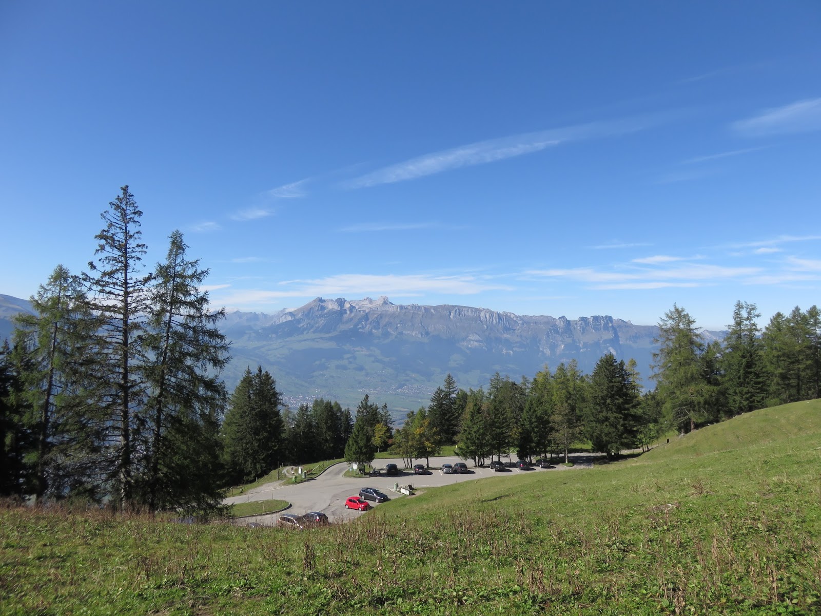
Best view from a car park since the Bernina express (which was less than 3 days before!) 


We were not crushed by falling rocks


Not bad 'eh?
Looking out


Top of the world!
Spot the Kat
Looking down


Bliss


What a walk!
Still with an eye out for rocks above
A final look back at Vaduz as we left
We could even take them with us in the car

Sunday, 20 September 2015

Spain part 3: Picos de Europa

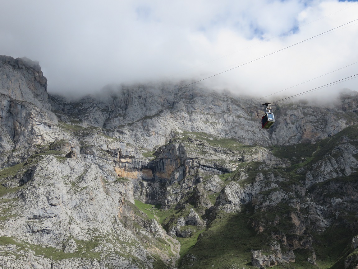
Not far from Santander are the Picos de Europa.  With a cable car that can help you climb all the way to the very top, we just had to visit.

Because we had the weekend free, we were trying to work out how to get the bus there on Saturday and back on Sunday, but in the end, we could not really confirm when the bus would return, and we could not find a local tour agency that could arrange getting us there.  It was far simpler to rent a car for 24 hours, and do the trip ourselves.  This actually gave us a great deal of flexibility, and meant that we could use the car early the next morning to visit
some of the places in Santander that are a bit harder when tied to a public bus route & schedule.

We were up early (in Santander-terms) and at the rental agency by 9, but having lost our senses, we had left our passports at home.  In the end, with the delay of going back to pick them up we were on the road at about 9.45, and got to Fuente Dé by midday.  The clouds were thick, but relatively high up, allowing us to almost see all the way to the top, with the last few metres of the cable car's ascent blocked from view on the ground.  


Can't see the top

Although there are only two cars that go up and down in tandem, we did not need to wait too long before starting our ascent.  Crammed in with 18 others, there was little room to move, but our strategic positioning meant we had both a great view of the ground, and the "flight" upwards.  Looking back down from the top took your breath away and it was hard to believe we had covered so much height in such a short time.  


From the top 


With a cloud blanket
The clouds had lifted slightly, allowing us to sit just under them, admiring the view and munching on our prepared lunch.  Others were smarter than me (Kat), and recognised the need for warmer clothes at high altitude, so I was keen to get moving.  We walked amongst the mountains for a few hours, stopping as we felt like it, exchanging pleasantries with mountain goats, and chatting to a sheepdog who had very little interest, in us or anything else for that matter.


Nothing to see here
Once amongst the hills, we were lost to all sounds of people and civilisation but for the occasional tinkling of a sheep/goat's bell in the distance. If Kat hadn't been sick during this period, we would have done the 16km loop walk back down to th car park but as it was, she wasn't quite up to it.  It was a lovely day, so instead we sat, and talked and walked and sat and talked and walked and did it again in reverse until we were back at the cable car station, with no one in line but ourselves to enjoy the relaxing ride back down.


Cubby holes
On a break
Pictures of rocks

We punctuated the 2 hour drive home with a stop in the river-side town of Potes.  It was a beautiful place and we enjoyed walking the backstreets downhill from our car park to the small river and taking in the last of the sun with a coffee and tapas.

We woke early the next morning to enjoy a slow and late sunrise over Santander Bay and then explored further west along the northern coastline before it was time to return the car.  We found a nice spot where the light should start from just behind the palace. There were far fewer people out and about that I had expected.  At home I would normally expect a place to be buzzing with cyclists and runners and dogs and all sorts.  But our morning friends were a sole backpacker, a man with a pipe and a dog, and another man with a metal detector.  As the sun started to shine through the beach cleaners also put in an appearance.  Not much happens before 9 or 10 am in Santander!


Man and dog (and pipe)
As the sun progressed on its journey, we drove further north, and found an even better spot overlooking a small inlet.  It was so good to be able to move from place to place with our own car.

For the best spot to see sunrise, it is hard to go past Parque de Cabo Mayor, make sure to find the lighthouse!


Little car enjoying sunrise

Costs:
* 16 Euro/pp return cable car
* 25 pounds car rental (it was easier to book through a British website)

Glad we found this spot

Tuesday, 12 May 2015

Kamikochi (Paradise)

Kamikochi
From Takayama we took a day trip Kamikochi to do some walks. 


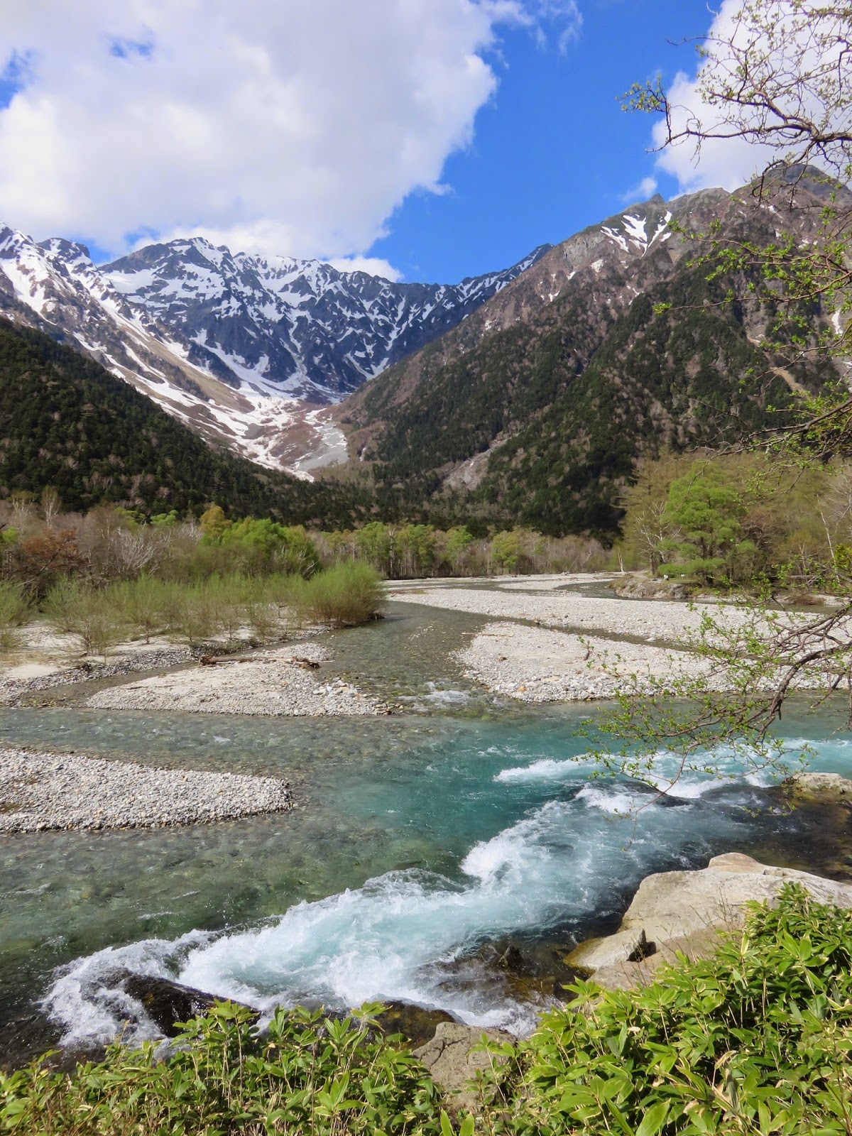
Kamikochi is a valley within the Hida Mountains range in Nagano Prefecture and part of the Chubu Sangaku National Park. It is sometimes compared with Yosemite Valley, California. The mountains bordering Kamikochi reach 3,190 metres and include Mount Yake, an active volcano. Lake Taisho was formed by the Mount Yake eruption of 1915.

The stunning landscapes that greeted us were simply spectacular and not what I would necessarily have pictured to find in Japan. (Just from simply not knowing enough about Japan!) The Azusa river has beautiful clear, sparkly water and there are breathtaking views throughout the valley. Hopefully our photos capture even a tenth of its beauty.


The area was previously used for logging until the mid-19th century. It is now heavily protected. Private vehicles have been restricted from entering the park and there is only modest development within it. (The public transport in is also on the pricey side.) These factors combine to make for some very peaceful walking. The facilities that are present are of a high quality and it is a nice atmosphere. It would be great to come back and do some mountain hiking and perhaps camp for a few nights. 


Tips for Kamikochi:

Website: www.kamikochi.org - really good English resources on how to get there

Opening season: Mid/late April to November 15

Climbing peaks: mid June and mid September

Getting there: 4900JPY return bus from Takayama (transferring at Hirayuno-Mori), takes about 1h45m.

Walking around
There is a park visitor centre with maps to purchase and information. Simple map below.

Recommend including Taisho Pond in your walk (either getting off the bus there early or walking there). The last bus left from Kamikochi bus terminal at 17.00 when we were there and went past Taisho Pond approximately 17:10. 

Suggestion to go to Hirayuno-Mori Hot Springs (we didn't but looked great)
Open 10am-9pm 500JPY bathing fee


General map of the park