Showing posts with label recommendations. Show all posts

Monday, 28 September 2015

Aboard the Bernina Express!

We are BLOWN AWAY after travelling on the Bernina Express from Tirano, northern Italy to Chur, eastern Switzerland. On the journey you are immediately amongst beauty, surrounded by ice capped mountains, turquoise lakes, quaint villages and a fantastic glass roof to view it all through. (The roof is not entirely glass, much to the disappointment of the young girls in our carriage, “Dad, where’s the glass roof? You said it was glass!”) The train is a narrow gauge train run by the Rhätische Bahn.

Excited to board the Bernina!
On-board with the view-enabling windows


It was easily the most scenic train trip I have ever done. The journey had been a travel dream of mine since before my first trip to Europe in 2010. At that time, I had decided to skip Switzerland to concentrate on slower travel through France, Italy and Spain. It was well worth the wait and something I would highly recommend.


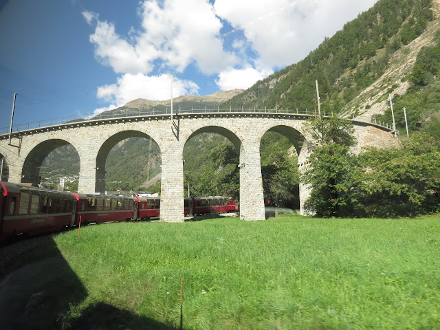
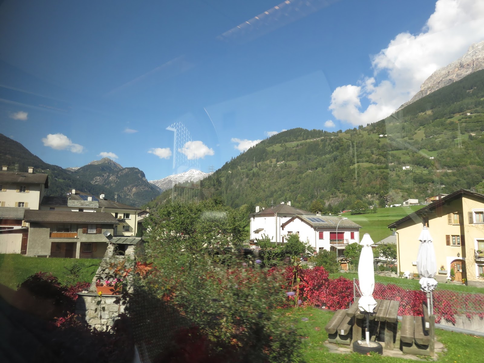
Along the way, Rob and I were entranced by the spectacular scenes outside our window as we rapidly climbed out of the valley near Tirano and up the steep track (at a rate of up to 70 metres per mile). We marveled at how clever it was to use the twists and turns to ascend the mountains (see the Brusio Spiral here). The railways architectural and civil engineering achievements are actually what made it find a place on the UNESCO World Heritage list. At one point early on in the trip we even “became a tram.” Across the route there were several tunnels and bridges (one is the longest in Europe.) We also went past a glacier, some castles, villages, a hydroelectric power plant and the highest airport in Europe! It was a beautiful area and one that you would be lovely to see via hiking, mountain biking, cycling or driving. Travelling by train was a brilliant way to experience it.


Rob’s favourite part of 122km journey was the steep ascent at the beginning. Even though we had some idea of the route we were still surprised as we watched the front of the train go up and up and up – it felt like a plane taking off! Not long after leaving Tirano, we encountered the Kreisviadukt Brusio, an amazing construction that sees the train spiral around on a 360 degree curve, allowing a rapid climb within very little space. During this part it was hard to know which way to look! 


Perhaps even harder was when we got closer to the highest point of the journey, Ospizio Bernina at 2253 metres above sea level. This was my favourite part. The sun was shining on the beautiful mountains and the contrasting mix of colours from the pine trees, rocks, grass and snow was stunning. Some people might prefer the journey in winter to see more snow, and no doubt it would be beautiful, but I rather liked the view with a little snow and lots of other colours.

Travelling through Alp Grüm our surrounds included Palü glacier and lake Palü and we had views of the Italian alps. Once at the highest altitude station on the railway network, Ospizio Bernina, we had crossed from Italian speaking areas in Italy and Switzerland into the Engadin region where Romansh and  German is spoken. From Ospizio Bernina you can see two neighbouring pools of water, one draining to the Adriatic Sea (Lago Blanco) and the other to the Black Sea (Leg Naire). The colour of the water in each was markedly different which was a strange sight.  Apparently we owe that difference to the fact that Lago Blanco is filled with glacial melt from Cambrena Glacier and Leg Naire is a peaty depression which collects murky brown water.

As well as a fantastically scenic ride, I can only imagine what this train route did for small villages once isolated by the Alps. It made me think about Mongolia and how influential further transport development could be for the country. 


Tips:
  • If you can, INCLUDE THIS TRIP IN YOUR LIFE!
  • Pack some snacks. There is not much choice on board. (No ice creams for the kids in our carriage as promised.)
  • There are some spots where you can take photos without a window in the way, but you’ll have to stand up and might not be worth just enjoying the view.
  • The Man at Seat 61 provides some great information. Including a cheaper means of riding on the Bernina. We did this and despite a bit of confusion in Tirano, it worked a treat.


Stunning Lago Blanco

Our neighbour enjoying the view over Lago Blanco

What a journey!
Look out the window!
Beautiful 

Going past Leg Naire

A barren landscape on part of the journey

A great place to stop apparently!


Thursday, 4 June 2015

Ulaan Bataar and camping in Teralj National Park

Ulaan Bataar
Arriving in Ulaan Bataar (UB) from our border crossing adventure we were keen for a bit of relaxing time before heading off to the Gobi. We also needed to find a tour as currently it is a necessity for seeing most of the country. Sunpath hostel was just the place to do both of these things and our hosts, Doljma and Patcha, made everything easy and pleasurable from the moment Patcha met us at the train station. 

I’ve heard people say that UB is a city to “get in and get of.” Having never really found a city that would I would apply that expression to, whether ugly, polluted or poverty-stricken, all cities have something to offer at least first time visitors, I always ignore that advice. During our time in UB we enjoyed walking around town. There always was something happening at Sukhbaatar (Chinngas Khan) square. While we were there we saw a ger-making competition and the famous Children’s Day. Festivities seemed very inclusive with many free activities for all to enjoy. We visited a beautiful monastery and marvelled at the mixture of modern architecture, soviet style buildings and gers, all in or near the city centre. Despite the overwhelming choice of restaurants and cafes (and cuisines), we even found a regular coffee spot during our stay.

Children's Day fun

Discouraging litter using lolly rewards 

Ger building competition

Ger competition final product
Prayers at the monastery

Birds alive!
Sukhbaatar (Chinngas Khan) square
Tips for UB 
Hostel: Sunpath
Tours: Sunpath 
Coffee/Café: Cafe Cielo 

Camping at a Mongolian National Park
Keen to spend at least a few days independently exploring the Mongolian countryside, we borrowed a tent (yes, no rental fee!) from Sunpath hostel and set off on a bus to Teralj National Park (Gorki Teralj), some 50km out of UB. Despite having a piece of paper asking for help to get on the right bus in Mongolian and being at the stop very early (because it could leave up to 30 minutes either side of the timetable apparently), we still managed to find ourselves on the wrong one. However, as is often the case, a small mishap is when the adventures really began!

On the (wrong) bus we witnessed an argument about a seat that escalated into a punch being thrown. Not long after this the conductor, who had successfully restored peace, signalled to us to get off the bus and said “Teralj”. We were clearly in a small village and not the National Park but the bus was about to head off in the wrong direction so we were left with no choice and hopped off. Optimistically we asked a policeman when the next bus to Teralj came through. He, and later a shop keeper, both shook their heads, directing us to a taxi. As we stood in a small parking lot deciding between the taxi or trying to camp/stay in the village, another man (Gambot) approached us and offered us a lift. Hesitant but with a good feeling about the guy, we headed to his car. We met his wife (Saska) and hit the road, unable to communicate too much except to find out he was an engineer at one of the tourist ger camps at Teralj.

We hadn’t been in the car very long when he started saying “goat” and “dinner”. Realising they meant to purchase a goat along the way we (somewhat oddly) relaxed about the whole hitching “this could go wrong” situation. It was bizarre how quickly you got used to have goats hanging out in the boot behind you.  In fact, you forgot about them until they protested a bad spot in the road. We had a few laughs with Saska and Gambot, enjoyed the scenery and soon we were staring at Turtle Rock, the signature rock in the National Park. Strange as it might sound, I think looking back this little trip with the goats will be one of the big highlights of 2015! At the time I also reflected upon how activities (e.g. hitchhiking) that are often advised against in travel blogs/guides, are also the stories that make up those very authors’ highlights reel. 

How to choose a goat
How to fit goats in
After arriving at Teralj we still actually had another 10km to walk to where we had planned to camp. It was getting late but luckily the sun doesn’t go down until about 11pm this time of year and there was some beautiful scenery (including model dinosaurs and a horse that thought it was a cow) to energise us on our way. It wasn’t until a few km’s to go, coincidentally when a big hill appeared in front of us, that a car stopped and offered us a lift. After a shorter walk along the river we found a spot alongside it to set up camp. I guess sometimes it’s true what they say about the journey not the destination.

We barely saw anyone during our time camping along the river. We took a lazy walk, read, slept, watched horses and ate. It was great! Our batteries were well and truly recharged in time for the big trip to follow.

The famous turtle rock

Us and the dinosaurs!
All my horses! 

Our campsite (tent can be spotted through the trees)

Horse racing along nearby

"Our" stream
Evidence
Our traditional tent photo as the sun went down around 11pm!


Tuesday, 12 May 2015

Kamikochi (Paradise)

Kamikochi
From Takayama we took a day trip Kamikochi to do some walks. 


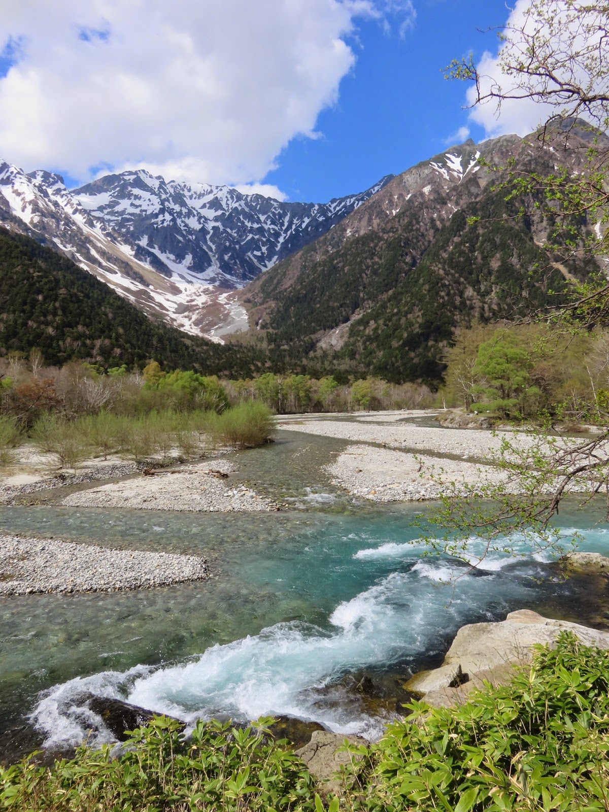
Kamikochi is a valley within the Hida Mountains range in Nagano Prefecture and part of the Chubu Sangaku National Park. It is sometimes compared with Yosemite Valley, California. The mountains bordering Kamikochi reach 3,190 metres and include Mount Yake, an active volcano. Lake Taisho was formed by the Mount Yake eruption of 1915.

The stunning landscapes that greeted us were simply spectacular and not what I would necessarily have pictured to find in Japan. (Just from simply not knowing enough about Japan!) The Azusa river has beautiful clear, sparkly water and there are breathtaking views throughout the valley. Hopefully our photos capture even a tenth of its beauty.


The area was previously used for logging until the mid-19th century. It is now heavily protected. Private vehicles have been restricted from entering the park and there is only modest development within it. (The public transport in is also on the pricey side.) These factors combine to make for some very peaceful walking. The facilities that are present are of a high quality and it is a nice atmosphere. It would be great to come back and do some mountain hiking and perhaps camp for a few nights. 


Tips for Kamikochi:

Website: www.kamikochi.org - really good English resources on how to get there

Opening season: Mid/late April to November 15

Climbing peaks: mid June and mid September

Getting there: 4900JPY return bus from Takayama (transferring at Hirayuno-Mori), takes about 1h45m.

Walking around
There is a park visitor centre with maps to purchase and information. Simple map below.

Recommend including Taisho Pond in your walk (either getting off the bus there early or walking there). The last bus left from Kamikochi bus terminal at 17.00 when we were there and went past Taisho Pond approximately 17:10. 

Suggestion to go to Hirayuno-Mori Hot Springs (we didn't but looked great)
Open 10am-9pm 500JPY bathing fee


General map of the park